Subject: United States, Pennsylvania, Atlas
Period: 1928-31 (dated)
Publication:
Color: Printed Color
Two unusual items by the enterprising Langwith Publishing Co.:
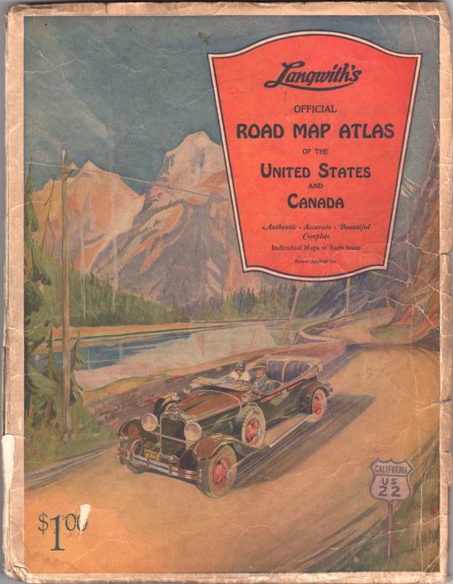
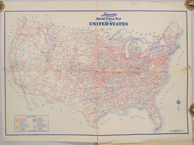
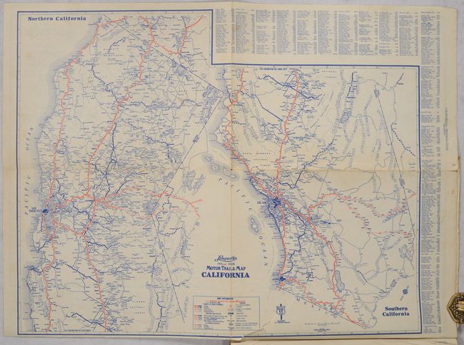
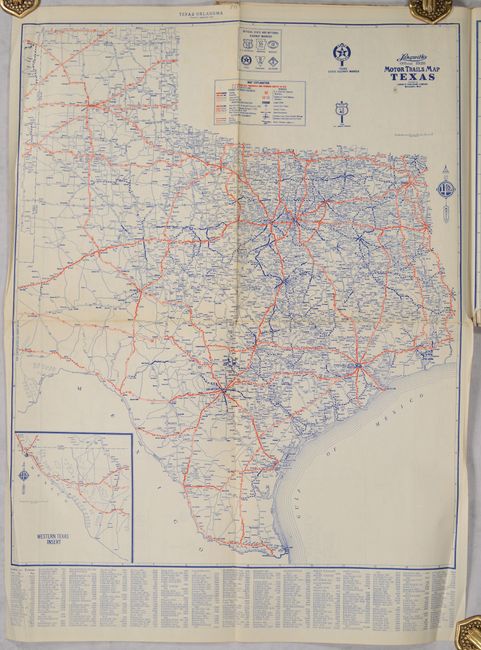
A. Langwith's Folding Road Map Atlas of the United States and Canada, published 1928 (9.5 x 12.3"). This road atlas contains a folding map of the United States and 17 folding maps of states/regions. The publisher proudly announces on the title page: “There is but one Langwith’s – there is not, nor can there be another Folding Road Map Atlas. If one appears, it can be only an infringement. Several expensive years were spent perfecting Langwith’s Folding Atlas. It is superior! Patent applied for.” The large, detailed folding maps each begin Langwith’s Official 1928 Motor Trails Map… and are intended to be unfolded in a precise manner as illustrated at the rear endpaper. Each contains a legend identifying highways, paved roads, improved roads, graded roads, and even dirt roads. Mileages are noted between towns. While Canada is noted in the title, only roads in Ontario are shown. First edition. Pictorial wrappers. Condition: The maps are generally good with some awkward opening tears and creasing along the sheet edges. The U.S. map has some insect damage along the left and right borders and the Kansas map has a long tear with some loss (C+). Covers are worn and the front cover is nearly detached. (B)
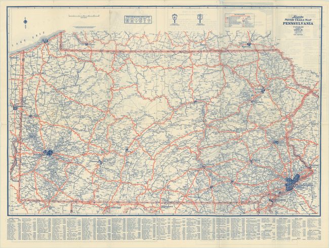
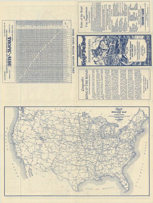
B. Langwith's Motor Trails Map Pennsylvania, dated 1931 (22.9 x 15.4"). A detailed highway map of the state with the same details as the maps in the atlas above. The verso contains a U.S. mileage map, mileage chart, and text describing Langwith’s plan for the King O’ The Road series, his personal experience in inspecting nearly one-half million road miles, and folksy trip suggestions including “Let the TRAIN have the RIGHT OF WAY – it will anyway.” Folds into pictorial wrappers. OCLC does not have a record of this map and shows only four maps in this series, all published around 1931. Despite the distinctive graphic cover art well before it became popular in road maps, it appears Langwith’s mapmaking enterprise perished during the Great Depression. Condition: Issued folding on a clean bright sheet. (A)
References:
Condition:
See description above.