Subject: Eastern United States
Period: 1804 (circa)
Publication: American Pocket Atlas
Color: Black & White
Size:
12.6 x 9.8 inches
32 x 24.9 cm
Mathew Carey was a seminal figure in early American publishing; establishing the first publishing firm to specialize in cartography and issuing the first atlas devoted exclusively to American maps. He set up an elaborate cottage system of craftsmen for compiling, engraving, printing, and coloring maps. This practice was emulated by later American cartographic publishers such as John Melish and Henry S. Tanner. The American Atlas concept was also adopted by other publishers in both the United States and Europe.
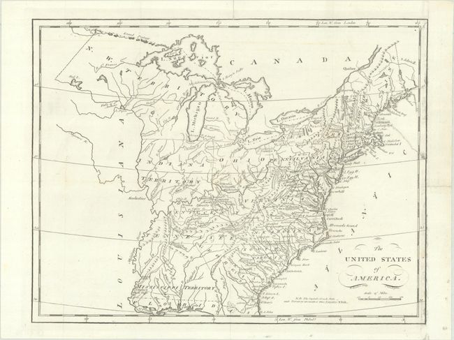
This map of the young United States covers the region from Maine south to Florida and west to the Mississippi River. West of Georgia is the short-lived Mississippi Territory, which includes present-day Mississippi and Alabama, with Muscle Shoals named. There is a large Northwest Territory spanning present-day Minnesota, Wisconsin, and Michigan. Chicago is named. Bellin's spurious islands are located in Lake Superior including I. Royal. A Grand Portage extends west. Unlike earlier states of this map, Vermont is identified. Inland detail includes rivers, topography, roads, and some place names. Among the place names added to this later state are Penobscot, Salem, Newark, Hudson, and Norfolk. Circa date is based upon Ohio being a state (1803) and no Michigan Territory (1805).
References: Wheat & Brun #131.
Condition: B+
Issued folding on a bright sheet with an archivally repaired 2" edge tear at right and a repaired short fold separation in the top blank margin. Remargined at right.