Subject: Eastern United States
Period: 1843 (circa)
Publication: Ewing's New General Atlas
Color: Hand Color
Size:
8.5 x 7.2 inches
21.6 x 18.3 cm
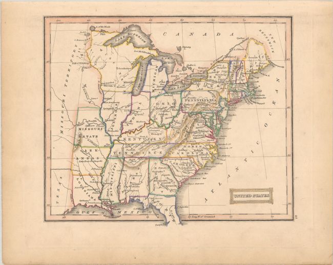
This interesting map of the United States tracks changing territorial boundaries. It extends as far west as the vast Missouri Territory, with Texas named in the far southwestern corner. On this edition, Wisconsin Territory has replaced the Northwest Territory and includes present-day Minnesota and Michigan's Upper Peninsula. A vaguely defined Iowa Territory appears to the north of Missouri State. Maine's northern boundary is noted to have been settled by treaty in 1842. The Ohio and Erie Canal is depicted with a bold line.
References:
Condition: A
Contemporary outline color on a faintly toned sheet with minor soiling mostly confined to the margins.