Subject: World
Period: 1744 (dated)
Publication: A Complete System of Geography
Color: Black & White
Size:
17.5 x 14.3 inches
44.5 x 36.3 cm
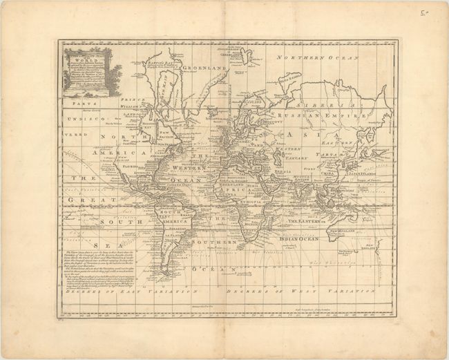
This unusual thematic chart of the world shows the magnetic variations throughout the world. Edmond Halley set out in 1700 to chart magnetic variation in order to solve one of the great problems in nautical navigation: the accurate determination of longitude. His initial work was expanded on by several British navigators in the 1740s, as represented by this map. Geographically the map shows an incomplete northwestern coastline in North America and a partially formed Australia and New Zealand, with a conjectural coastline suggesting that Australia and New Guinea are connected. De Gama's Land and Company's Land appear to the east of Yedso. The map does not show interior features, instead concentrating only on coastal place names with dates of important discoveries in the oceans.
References: McCorkle (18th C. Geography Books) #17-1; Shirley (BL Atlases) T.BOW-2a #3.
Condition: B+
A nice impression on a sheet with the Lily watermark of papermaker Lubbert van Gerrevink. There is minor offsetting and foxing and light soiling that is mostly confined to the margins.