Catalog Archive
Auction 198, Lot 131

"A New Map of North & South Carolina, & Georgia. Drawn from the Best Authorities", Kitchin, Thomas

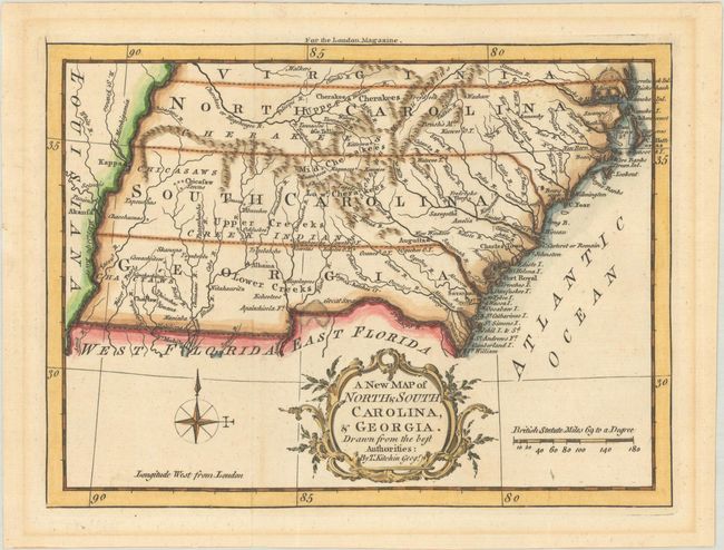
Subject: Colonial Southeastern United States

Period: 1765 (published)

Publication: London Magazine

Color: Hand Color

Size:
9.1 x 6.8 inches
23.1 x 17.3 cm
Download High Resolution Image
(or just click on image to launch the Zoom viewer)

This charming small map of the southeast shows the boundaries of North Carolina, South Carolina, and Georgia extending from the Atlantic coast to the Mississippi River, illustrating the territorial gains the British made during the French & Indian War, which ended in 1763. Numerous Indian tribes are named in the frontier land west of the Appalachians including the Cherokee, Chickasaw, Creek, and Choctaw tribes. The map also depicts towns, Indian villages , forts, watersheds and the topography of the land. Published in the April 1765 issue of London Magazine.

References: Cumming #348; Jolly #LOND-244; Phillips (Maps) p. 295, 613 & 819; Sellers & Van Ee #1390.

Condition: A

A sharp impression issued folding with marginal toning.

Estimate: $375 - $450

Sold for: $275

Closed on 6/19/2024

Archived