Subject: Colonial Southeastern United States
Period: 1777 (dated)
Publication: Atlas Ameriquain Septentrional
Color: Black & White
Size:
21.3 x 16.1 inches
54.1 x 40.9 cm
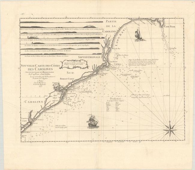
This rare map charts the Carolina coast from Cape Fear to Edisto Island and was based on the manuscript charts of Nathaniel Pocock from 1770. The map appeared in Atlas Ameriquain Septentrional, which was published for use by the French Navy shortly after France's entry in the American Revolutionary War. The map focuses on navigational details such as depth soundings, shoals, anchorages, and descriptions of the ocean floor. Also included are eight profile views of various parts of the coastline. Charleston and Georgetown are depicted as miniature town plans. Place names along the coast are partly in French and partly in English, and a translation of English terms is included off the coast. The map is adorned with two sailing galleons and a compass rose.
References: Sellers & Van Ee #1398; Shirley (BL Atlases) T.LER-3a #23.
Condition: A
A sharp impression on a bright sheet with the watermark of a Maltese cross encircled in rosary beads. There are two printer's creases at left and a short centerfold separation in the top margin.