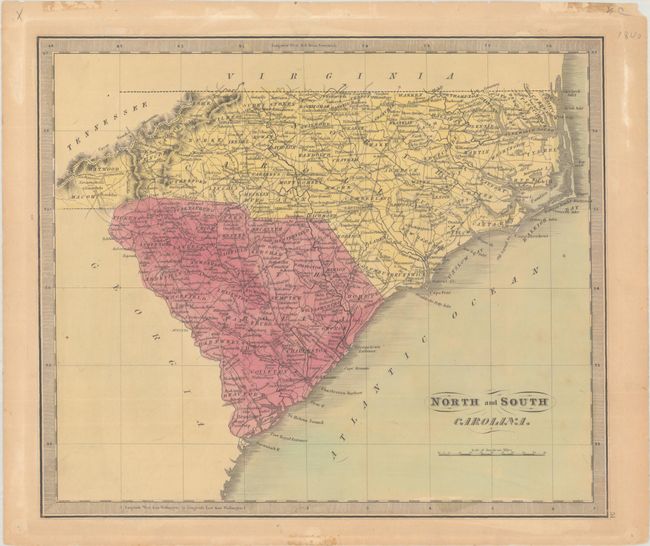
Subject: North Carolina & South Carolina
Period: 1840 (circa)
Publication: A New Universal Atlas...
Color: Hand Color
Size:
12.7 x 10.8 inches
32.3 x 27.4 cm
This handsome and detailed map of the Carolinas delineates roads, towns, villages, settlements, ports, watershed, and more. County configuration in North Carolina predates 1835, with no sign of Davie County. Early railroads span from Charleston to Augusta; Clinton to Wilmington; and Raleigh to New Bern. The map is surrounded by a keyboard-style border and with fancy titling. Jeremiah Greenleaf took over the production of David Burr's New Universal Atlas when Burr was appointed Geographer of the House of Representatives in 1838.
References: Phillips (Atlases) #784-51; Rumsey #15176.055.
Condition: B+
Full contemporary color on a lightly toned sheet with pinholes and tape residue in the blank margins.