Subject: Central United States
Period: 1837 (published)
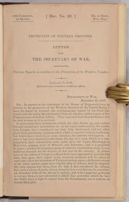
Publication: H.R. Doc. 59, 25th Congress, 2nd Session
Color: Black & White
Size:
15.2 x 21.6 inches
38.6 x 54.9 cm
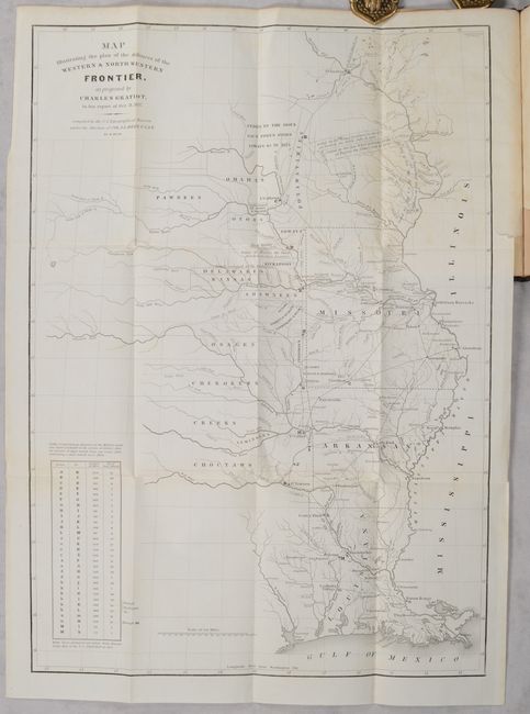
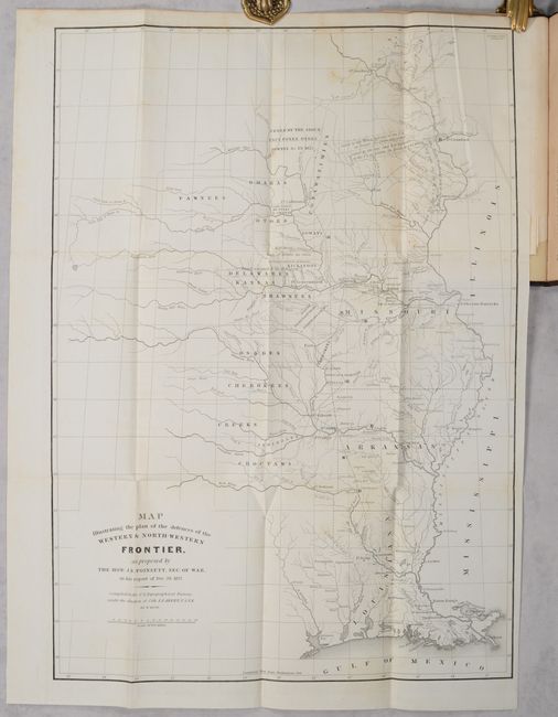
These two maps depict the Congressional debate over the nature of the Frontier Defenses between the Mississippi River and the Rocky Mountains, illustrating the proposals of J.R. Poinsett and Charles Gratiot. Both maps depict the states of Missouri, Arkansas, Louisiana, and Indian nations bordering them to the west. Military forts and outposts from Ft. Jessup to Ft. Snelling are designated, and notations identify the lands ceded by several Indian nations with dates of the treaties. The threat posed by hostile Indians, whose numbers greatly exceeded those of the settlers in the area, resulted in a protracted Congressional debate concerning the defenses required along the frontier. Poinsett's plan is less detailed. Gratiot’s plan adds a table showing distances between forts and "days of march" at 15 miles per day. Accompanied by the original 19-page report. Rebound in quarter faux leather over beige cloth (5.7 x 9.2").
References: Wheat (TMW) #426 & #427; Clausen & Friis #182 & #183.
Condition: B+
The folding maps are on mostly clean bright sheets with a bit of light soiling, a few spots of foxing, and short binding tears at right. Text is lightly toned. Modern binding is near fine.