Catalog Archive
Auction 198, Lot 141

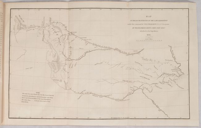
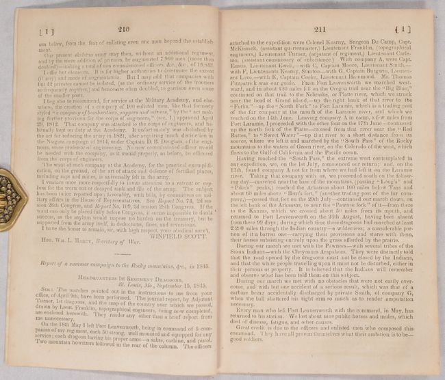
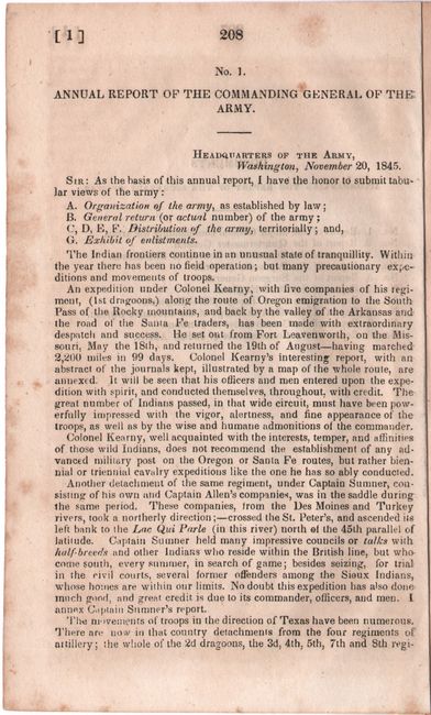
"[Map in Report] Map of the Route Pursued by the Late Expedition Under the Command of Col. S.W. Kearny, U.S. 1st Dragoons [in] Report of a Summer Campaign to the Rocky Mountains...", Franklin, William Buell [Lt.]

Subject: Western United States

Period: 1845 (published)

Publication:

Color: Black & White

Size:
13.1 x 8 inches
33.3 x 20.3 cm
Download High Resolution Image
(or just click on image to launch the Zoom viewer)

This is an early and historical map of the region that is based in part on Fremont's map of 1843. It covers the region between the Arkansas and Platte Rivers, and extends westward to South Pass and the Green River. The dragoons departed Ft. Leavenworth and marched to South Pass via the Oregon Trail and returned 99 days later via the Arkansas River route, a distance of 2,200 miles over the tough western terrain. Engraved by the firm of Smith & McClelland. The map is still attached to the original 11-page disbound report.

References: Wagner-Camp #117; Wheat (TMW) #495.

Condition: B+

The folding map is very good with a hint of offsetting. Disbound text has some minor toning and foxing.

Estimate: $200 - $230

Sold for: $250

Closed on 6/19/2024

Archived