Subject: Northern California & Oregon Coastline
Period: 1851 (dated)
Publication:
Color: Black & White
Size:
17.5 x 19.4 inches
44.5 x 49.3 cm
The Office of Coast Survey is the oldest U.S. scientific organization, dating from 1807 when Congress directed that a "survey of the coast" be carried out. By 1836, it was called the U.S. Coast Survey and in 1878, the name was changed to the U.S. Coast and Geodetic Survey. Today the Office of Coast Survey is a division of the National Oceanic and Atmospheric Administration NOAA.
The survey teams, composed of civilians as well as Army and Naval officers, charted the nation's waterways and produced a wide array of reports, survey charts, hydrographic studies of tides and currents, astronomical studies and observations, and coastal pilots. These charts are an important record of the changing nature of the nation's coastlines. In additional to coastal charts, the U.S. Coast and Geodetic Survey produced land sketches, Civil War battle maps, and the early aeronautical charts.
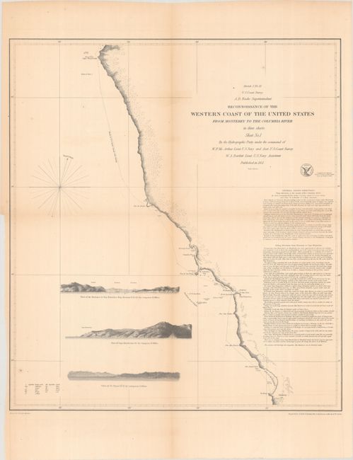
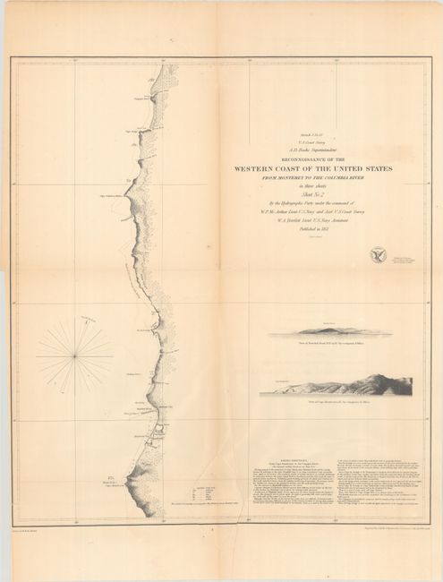
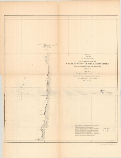
This detailed set of charts depicts the coastline from Monterey, California north to the Columbia River. All three charts were drawn by W.B. McMurtrie and engraved by A. Rolle, F. Dankworth, O.A. Lawson, G. McCoy & W. Smith. The charts contain the eagle seal of the Coast Survey, general and specific sailing directions and fathom soundings in the bays.
Sheet No. 1illustrates the California coast from Pt. Pinos at the southern tip of Monterey Bay to Cape Mendocino, including San Francisco and Drake's Bay. This chart has three engraved headlands views; Pt. Pinos, Cape Mendocino and Entrance to San Francisco Bay.
Sheet No. 2 shows the California and Oregon coast from Cape Mendocino in the south to the mouth of the Umpquah River in the north. Major points included are Humboldt and Trinidad Bay in California, and Klamath River, Pelican Bay and Rogue River in Oregon. The two headlands views are Trinidad Head and Cape Mendocino.
Sheet No. 3 depicts the northern Oregon coast from Cape Arago, mouth of the Kowes River, Umpqua River, up to the mouth of the Columbia River/Cape Hancock or Disappointment. The capes of Perpetua, Foulweather, Lookout and Killamook are located along the way.
References:
Condition: B
Issued folding with minor foxing, a few short splits at the fold junctions, and some extraneous creases on sheets 2 and 3.