Subject: Alaska
Period: 1959 (dated)
Publication:
Color: Printed Color
Size:
43.1 x 31.5 inches
109.5 x 80 cm
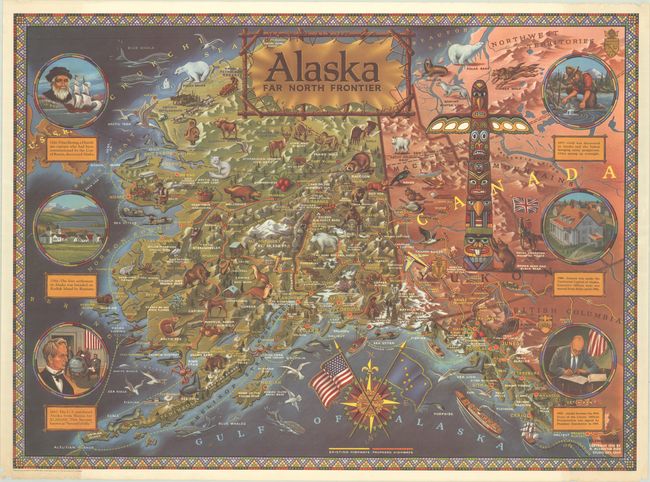
This appealing and graphic map was created to celebrate Alaska's statehood. In addition to the topography, cities, rivers, lakes, mountains, and existing and proposed highways of Alaska and western Canada, the map is teeming with illustrations of the wildlife of the region (including sea otters, timber wolves, and grizzly bears), several prospectors, bush planes, a train, a "Mountie", a massive totem pole, and various other local phenomena. Six circular vignettes run along the left and right sides of the map, depicting moments from the state's history, including Vitus Bering's discovery of the area, Seward's Folly, and President Eisenhower signing Alaska into statehood. The title of the map appears on a stretched piece of animal hide and a compass rose at bottom features the American flag crossed with Alaska's state flag. Surrounded by a beadwork-style border. Illustrated and published by R. Klengston "Kleng" Rude.
References:
Condition: A
A bright and colorful example with a bit of extraneous creasing, chipping and short tears in the top right and bottom left corners of the sheet, just entering the image a bit in the border at bottom left. There is an edge tear at bottom right that just touches the neatline and has been closed on verso with archival tape. The map has been tightly rolled and does not lay flat on its own.