Subject: California, National Parks
Period: 1937 (dated)
Publication: Westways
Color: Black & White
This lot features 4 rare pictorial maps highlighting California's natural attractions. They were originally published in Westways, the magazine of the Automobile Club of Southern California, and were designed by Lowell Butler, the magazine's art director. Each map features playful imagery of flora and fauna, topography, tourists, and classic American West iconography.
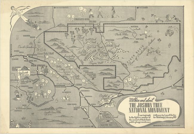
A. Within and About the Joshua Tree National Monument - A Cartograph in the Lighter Manner of the Newest of Uncle Sam's Public Playgrounds, (16.8 x 11.8"). This map was published just a year after President Franklin D. Roosevelt officially established Joshua Tree as a national monument. Locates Twenty-Nine Palms, Wonderland of Rocks, the Colorado River Aqueduct ("Where Southern California Will Get Water"), San Jacinto State Park, Palm Springs, Painted Canyon, Pinto Basin ("Home of Prehistoric Indians"), and the northern tip of the Salton Sea.
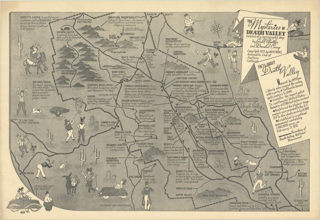
B. The Mysteries of Death Valley Collated on a Cartographic Map, (17.6 x 11.8"). Co-credited to Donald Curry. It includes notes on sites of interest, such as "The Race Track - An almost circular dry lake, with extrusions of granite that resemble grandstand and judges stand" and "Bad Water - Lowest point on four of the five continents - Drainage for entire valley."
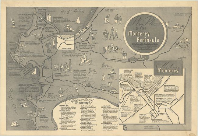
C. Play Places of the Monterey Peninsula - A Cartographic Map, (17.4 x 11.7"). Includes a chronology of Monterey and an inset depicting "Historic Monterey."
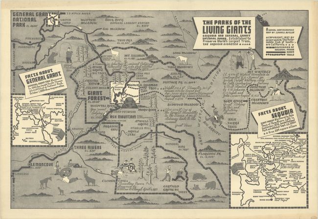
D. The Parks of the Living Giants - Sequoia and General Grant National Parks, Established to Preserve World's Largest Trees, the Sequoia Gigantea, (17.4 x 11.7"). Includes detailed insets of General Grant and Sequoia and identifies attractions like Giant Forest, Muir Grove, General Sherman Tree, Mt. Whitney, and much more.
References: Rumsey #11599.
Condition: B+
Maps have light toning and marginal soiling. There is light dampstaining in the Monterey map.