Subject: Central California
Period: 1849 (dated)
Publication:
Color: Black & White
Size:
19.8 x 21.3 inches
50.3 x 54.1 cm
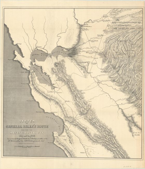
This important and early map of the California Gold Rush was made from Lt. Derby's original sketch by J. Mc. H. Hollingsworth in the office of the 10th Military Dept. It is historically important, not only for its depiction of Gen. Riley's route, but because it names, for the first time, certain actual mining camps in the middle Sierra foothills; Mormon Island (misspelled Mormont), Coloma (mislabeled Colluma), Curtis, Sullivan's, Corons, Jamestown, Woods, and Sonora. The entire route of the Riley party is noted, with the dates of their visits to the various camps, and covers the region from Monterrey Bay, north to Sacramento and east to the gold diggings.
References: Wheat (Gold) #79.
Condition: B+
Issued folding with minor extraneous creasing along the edges and several short fold separations primarily along the right sheet edge that have been closed on verso with archival tape.