Subject: World
Period: 1774 (dated)
Publication: Atlante Novissimo
Color: Hand Color
Size:
16.6 x 10.8 inches
42.2 x 27.4 cm
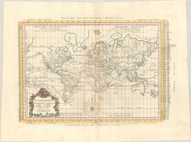
This attractive Italian map, presented on Mercator's projection, delineates the voyages of Cook and Bougainville. Greenland is shown connected to North America, and Alaska is considerably oversized. Terra di van Diemen is part of the Australian mainland, and New Zealand appears as two islands, albeit in an unusual stout configuration. The map is decorated with a garland-style title cartouche and a nice compass rose. The map is surrounded by information on time zones, climate, and the lengths of the days and nights.
References: Shirley (BL Atlases) T.ZAT-1a, Vol. 1 #6.
Condition: B+
A crisp impression with full contemporary color on a bright, sturdy sheet with the watermarks of a coat of arms and three crescent moons. Along the centerfold there is light toning and a light stain.