Subject: Monterey Bay, California
Period: 1933 (circa)
Publication:
Color: Printed Color
Size:
8.2 x 10.5 inches
20.8 x 26.7 cm
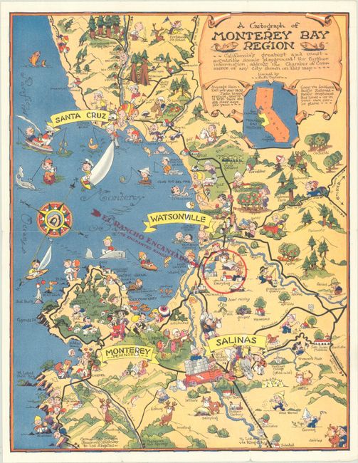
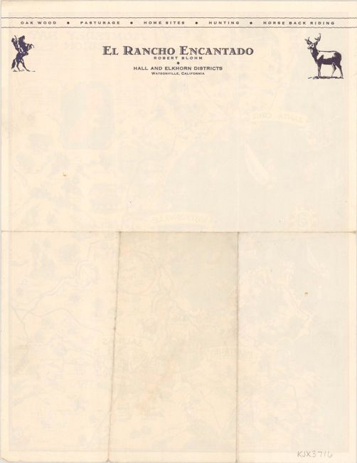
This is one of White's rarer pictorial maps, and shows the region surrounding Monterey Bay, a popular tourist destination. The map includes Carmel Highlands, Santa Cruz, Watsonville, and Salinas and presents the scenic sights in the area in White's playful style. The title notes that the area is "California's greatest and most accessible scenic playground," and just below the title it states "Come via Southern Pacific Railroad - Pacific Greyhound Bus Lines - or in your own car - or plane." On this example, a circle in red overprinting locates the El Rancho Encantado and the verso serves as a stationery note for the business. This is only the third time we have listed this map at OWA, and OCLC lists only six institutional holdings (5 in California).
References: Rumsey #11344.
Condition: A
Clean and colorful with some minor wear along the sheet edges.