Subject: Catalina Island, California
Period: 1852 (dated)
Publication:
Color: Black & White
Size:
10.8 x 15 inches
27.4 x 38.1 cm
The Office of Coast Survey is the oldest U.S. scientific organization, dating from 1807 when Congress directed that a "survey of the coast" be carried out. By 1836, it was called the U.S. Coast Survey and in 1878, the name was changed to the U.S. Coast and Geodetic Survey. Today the Office of Coast Survey is a division of the National Oceanic and Atmospheric Administration NOAA.
The survey teams, composed of civilians as well as Army and Naval officers, charted the nation's waterways and produced a wide array of reports, survey charts, hydrographic studies of tides and currents, astronomical studies and observations, and coastal pilots. These charts are an important record of the changing nature of the nation's coastlines. In additional to coastal charts, the U.S. Coast and Geodetic Survey produced land sketches, Civil War battle maps, and the early aeronautical charts.
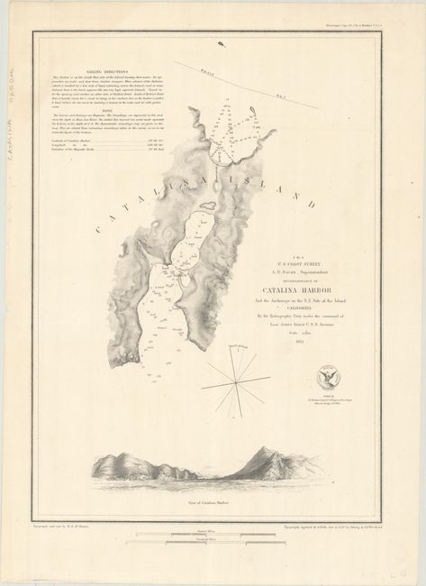
A seldom seen chart detailing Catalina Harbor and part of the island. The harbor is filled nautical information including soundings given in feet and the bottom type in several areas. At bottom is a well rendered and finely engraved view of the approach to the harbor with two sailing ships at anchor in the distance. The notes include sailing instructions, and the compass rose provides magnetic variation.
References:
Condition: A
Issued folding and now flattened and backed with tissue. There is a faint extraneous crease at bottom left, otherwise fine.