Subject: World
Period: 1788 (circa)
Publication: Atlas Encyclopedique
Color: Black & White
Size:
13.6 x 9.3 inches
34.5 x 23.6 cm
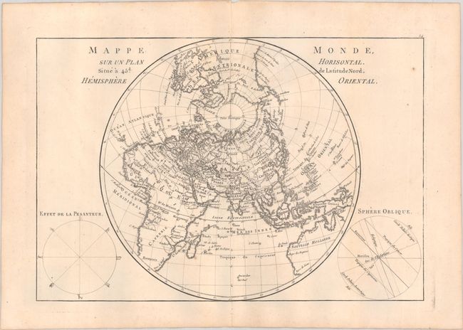
A. Mappe Monde, sur un Plan Horisontal. Situe a 45d. de Latitude Nord. Hemisphere Oriental. A fine circular chart, drawn with a north polar projection, with great detail of the countries, seas and oceans portrayed above the southern latitudes. The map extends to include the northern portion of North America and Australia. On either side of the map are two spheres, "Effet de la Pesanteur" and "Sphere Oblique," showing the equator, tropics, horizon & ecliptics. Condition: A fine impression on watermarked paper with a couple of tiny, insignificant spots. (A)
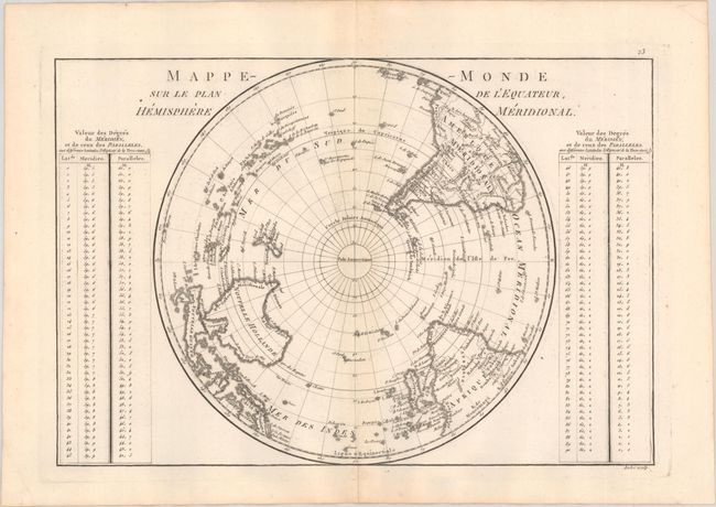
B. Mappe-Monde sur le Plan de l'Equateur, Hemisphere Meridional. South polar projection covering the globe from the pole to the Equator. Crisply engraved to include mountain ranges and a few place names. The mythical L. Xarayes is still shown in the interior of South America and Tasmania is connected to Australia. The map is flanked by tables giving the values of the degrees of the meridians and parallels for various latitudes. Condition: A crisp impression on watermarked paper. (A)
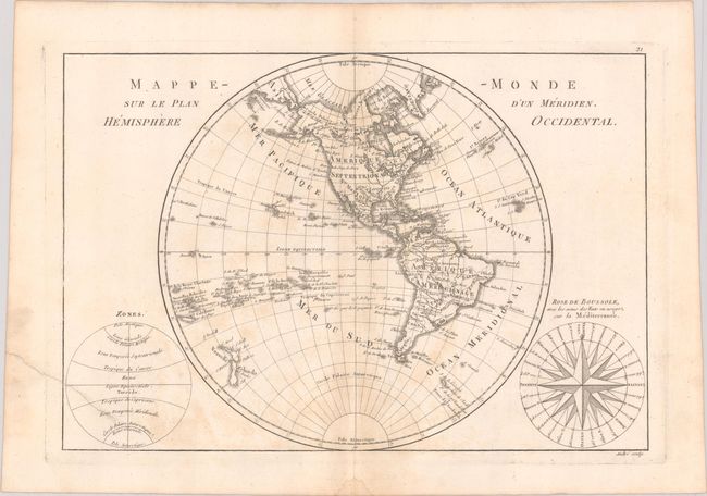
C. Mappe-Monde sur le Plan d'un Meridien. Hemisphere Occidental. Fine copper engraving shows North and South America with the Atlantic & Pacific Islands and New Zealand. Alaska is approximately the correct shape reflecting Cook's discoveries. At bottom right is a large wind rose called "Rose de Boussole," showing wind directions taken from charts in use in the Mediterranean Sea. A second diagram in the lower left corner balances the composition, with information on the poles and the circles of the earth. Engraved by Andre under the direction of Rigobert Bonne (1727-1795), the Director of the Depot de la Marine and Royal Hydrographer to the King. Condition: On watermarked paper with some light toning and an archivally repaired edge tear that extends 1.75” into the image at bottom left. (B+)
References:
Condition:
See description above.