Subject: Washington, D.C.
Period: 1890 (dated)
Publication: H.R. Doc. 445, 51st Congress, 1st Session
Color: Printed Color
Size:
28.7 x 27.3 inches
72.9 x 69.3 cm
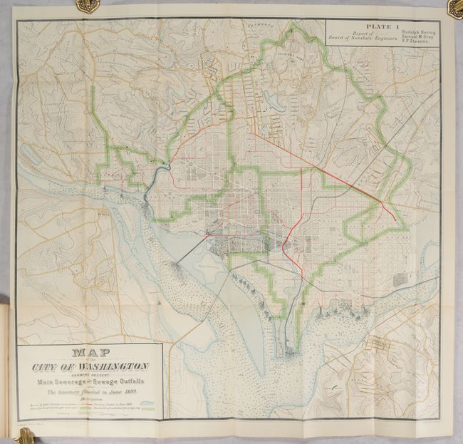
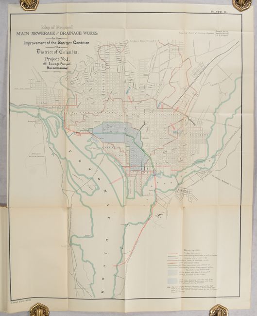
This report by the Board of Sanitary Engineers was issued following the Great Flood of 1889, which impacted a large section of the southern District including the Mall area. On June 2, the Potomac River crested at over 12 feet above flood stage and parts of Pennsylvania Avenue were covered in up to 4 feet of water. Included with this report is a large folding map showing this flooded region extending to nearly the Capitol, along with green and red overprinting indicating the existing sewerage network, which had failed to keep up with city's population growth. There is excellent detail throughout including roads, railroads, property owners, individual buildings, and even contour lines to identify low-lying areas. Accompanying this large map are 2 smaller folding maps with proposals for improving the sewer system and 7 other plates. 113 pages. Octavo, disbound.
References:
Condition: A
The large folding map is clean and colorful with a couple of small fold separations. Other plates and text are near fine.