Subject: Florida
Period: 1834 (dated)
Publication: A New Universal Atlas...
Color: Hand Color
Size:
10.6 x 12.9 inches
26.9 x 32.8 cm
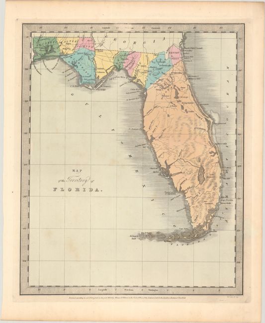
This rare early map of Florida shows county development and railroad lines in the northern part of the territory, prior to its statehood in 1845. The map includes the counties of Escambia, Walton, Jackson, Washington, Leon, Jefferson, Madison, Duval, Nassau, and Gadsden, which is shown but unnamed. The county of St. John's makes up the entire peninsula, which most closely matches its 1822 formation. Based on the 1834 date, many counties are missing, including Alachua (formed 1824), Hamilton (1827), Columbia (1832), and Franklin (1832). Additionally, there is no county development in central or southern Florida, although Mosquito, Hillsborough, and Monroe were formed by this time.
David H. Burr was appointed to be topographer to the U.S. Post Office Department in 1832 and was unable to complete the maps for his atlas. Thomas Illman assumed responsibility to complete the atlas, publishing it using the New York firm of D.S. Stone. The imprint of Illman & Pilbrow is below the neatline.
References: cf. Rumsey #4628.056.
Condition: B+
Full contemporary color with light foxing and marginal toning.