Subject: Florida; Northern Scandinavia
Period: 1834 (dated)
Publication:
Color: Black & White
Size:
14.5 x 16.7 inches
36.8 x 42.4 cm
The beginning of the nineteenth century saw a period of rapid market growth and innovation in the map publishing world. Increased literacy and public interest in new frontiers and colonies overwhelmed the market because it was oriented toward the small, affluent market of the previous century. With the intent to fill this void, The Society for the Diffusion of Useful Knowledge (SDUK) was founded in 1828 in London, by Lord Brougham and a group of men dedicated to the education of the aspiring working class and the Utilitarian ideal of 'Knowledge is Power.' The society produced an array of education materials, but the series of maps was one of their most successful ventures. A number of engravers and printers were used to produce the maps, which eventually exceed 200 sheets, and continued to be published after the Society as a whole ceased to function.
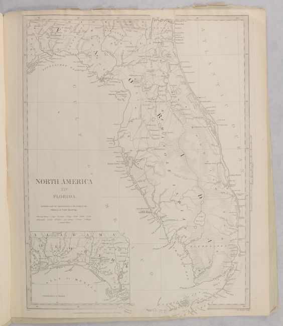
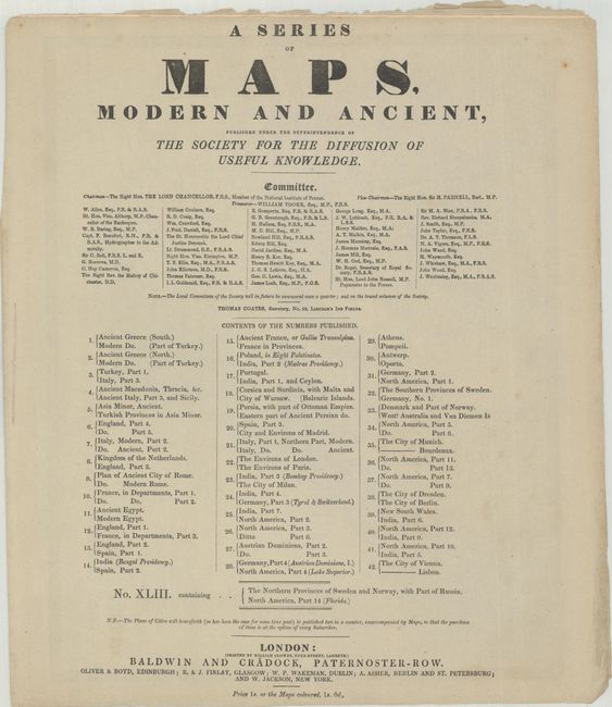
This lot includes two SDUK maps in their original paper wrappers. Starting in September 1829, the SDUK issued maps to their subscribers in a series of "Numbers" (or fascicles), each of which included a pair of maps. This is No. XLIII, with maps of northern Scandinavia and Florida. The Florida map is an early and very detailed steel engraved map of the territory, published eleven years before statehood. The western panhandle, from Apalachicola to the Perdido River, is shown in an inset on the same scale. South Florida is virtually empty of settlement, but is bisected by a long Indian Path. A large reservation for the Seminole Indians takes in much of the interior of the peninsula and the region around Charlotte Harbor. Lake Okeechobee (here Lake Macaco) is incorrectly located, which is a common error on maps of this period because the region was largely unexplored. The first railroad was chartered three years before this map was issued, but we find no mention of it here.
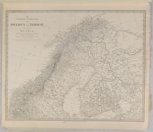
The other map covers the northern reaches of Sweden and Norway, all of Finland, and part of Russia. There is nice topographical detail and capes, fjords, glaciers, islands, lakes, mountains, ports, and more are identified. It extends as far south as Stockholm, which is located below the neatline. Both maps were engraved by J. & C. Walker and published by Baldwin & Cradock. Paper covers name SDUK committee members and list the 42 preceding fascicles. Price is listed as one shilling, with colored examples selling for an extra six pence. Back cover advertises other SDUK publications.
References:
Condition: B+
The maps are in very good condition with minor toning along the edges. A small part of the Florida map that extends into the bottom margin has been trimmed away, as issued. Covers have light foxing and chipping along the edges.