Subject: Florida
Period: 1850 (dated)
Publication:
Color: Hand Color
Size:
11.8 x 14.5 inches
30 x 36.8 cm
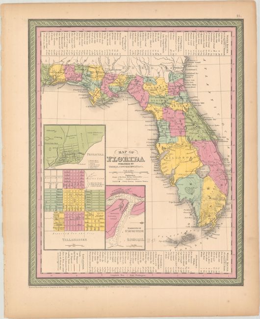
This is a very informative, early map of the state showing only 28 organized counties. Settlement in southern Florida is limited to a scattering of forts, including Jupiter and Lauderdale, and Key Biscayne. Three insets show the vicinities of Pensacola, Tallahassee, and the harbor of St. Augustine. The legend locates canals, railroads, and roads. Routes of the army during the Seminole War and battlegrounds are located as well. There are two short railroads linking Tallahassee with St. Marks, and St. Josephs with Iola. County development is current to 1849 as Benton County has yet to be renamed to Hernando, which occurred in 1850.
References:
Condition: A
Full contemporary color on a sheet with a few minor spots and light toning in the blank margins. The edges are reinforced with archival tape on verso.