Subject: Key West, Florida
Period: 1938 (circa)
Publication:
Color: Hand Color
Size:
29.9 x 21.6 inches
75.9 x 54.9 cm
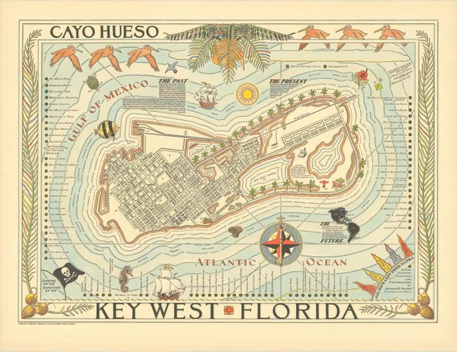
This delightful bird's-eye plan of Key West shows the extent of development on the island circa 1938. Numbered and lettered keys fill the waters surrounding the map and identify over 75 locations, including hotels, landmarks, beaches, parks, public buildings, factories, the salt ponds, and more. A small outline map of North and South America shows the planned Pan-American Highway starting in Key West and ending in Rio de Janeiro, Brazil. The map is surrounded by images that evoke a tropical feel, including pelicans, ships, a sea turtle, and a seahorse. Created by Arthur B. Suchy, a Cleveland graphic artist, who illustrated maps of both his home state of Ohio and his vacation state of Florida. Rare first collector's edition, one of only one hundred copies printed to be colored by hand.
References: Hornsby (Picturing America) p. 150, plate 71.
Condition: A+
On paper with a "Limweave Text - Made in U.S.A." watermark.


