Subject: World
Period: 1597 (published)
Publication: Descriptionis Ptolemaicae Augmentum
Color: Black & White
Size:
11.4 x 9 inches
29 x 22.9 cm
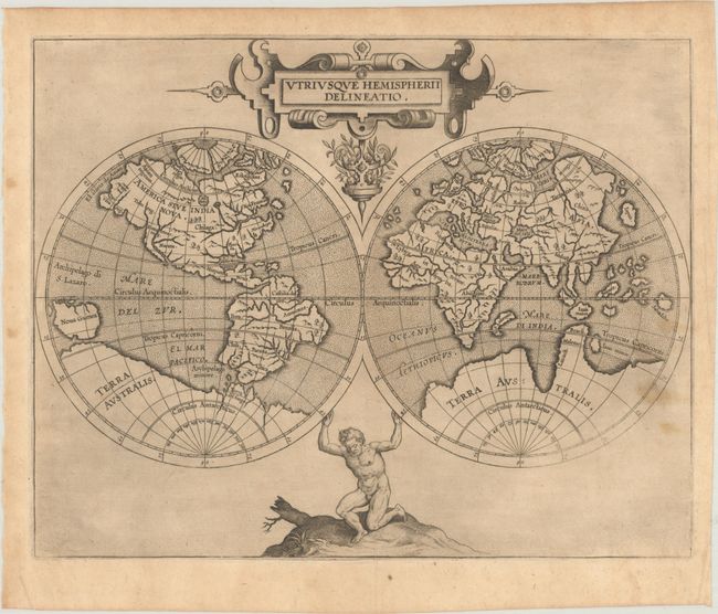
This delicately engraved world map is from the first atlas devoted entirely to the New World. Cartographically it is essentially a reduced version of Rumold Mercator’s map of 1587. The Southern Hemisphere is dominated by a vast Terra Australis. North America is presented with numerous large rivers, featuring the city of Norumbega in the Northeast and Anian Regnum and Quivira Reg. on the bulging western coast. Atlas holds up the double hemisphere map and an elegant strapwork cartouche completes the uncluttered design.
References: Shirley #207; Mickwitz & Miekkavaara #307-1.
Condition: B+
A dark impression on a sheet with a coat of arms watermark, two tiny tears along the centerfold, and several light stains in the image at right. There are small remnants of hinge tape on verso.