Subject: Maine
Period: 1830-38 (dated)
Publication:
Color: Hand Color
This lot features three maps highlighting the boundary dispute between Maine and Canada:
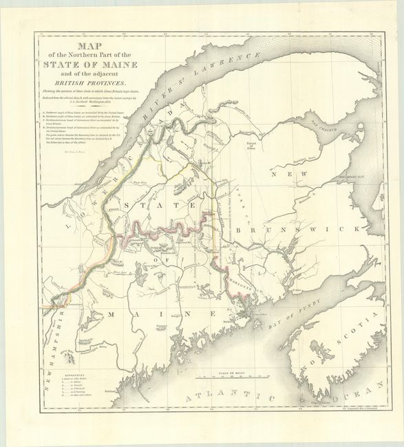
A. Map of the Northern Part of the State of Maine and of the Adjacent British Provinces, by S.L. Dashiell, dated 1830, hand color (15.4 x 16.6"). On this map, hand coloring is used to show the boundary as claimed by the United States and by Great Britain, with a third line labeled "that of the Arbiter" which closely corresponds to Maine's present-day border with Canada. A table gives the major points of contention in this border dispute. Another table names land grants belonging to six land holders. Reference: Claussen & Friis #220. Condition: Fine. Issued folding. (A+)
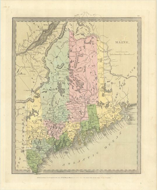
B. Maine, by Burr/Illman, dated 1835, hand color (10.6 x 13.1"). This atlas map depicts 10 counties with the northern boundary following the line of the Arbiter in the above map. It shows good detail of the coastline, offshore islands, lakes, wagon roads, settlements, and more. Condition: Contemporary color with a hint of toning. (A)
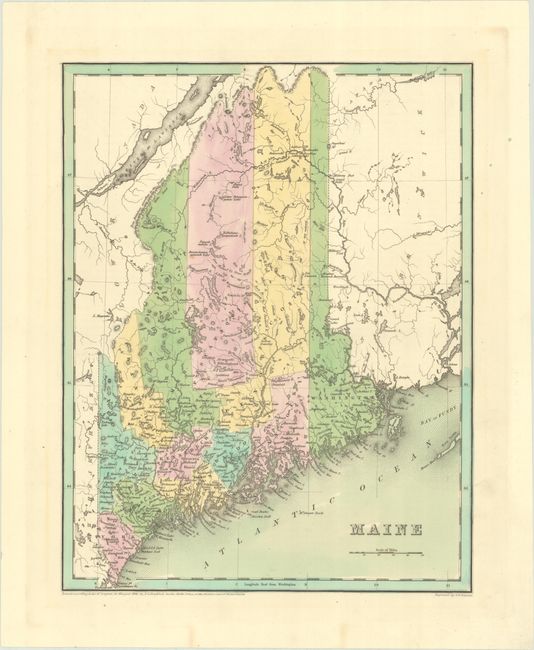
C. Maine, by Thomas G. Bradford, dated 1838, hand color (11.3 x 14.5"). This map extends further north that the Burr map above, showing the U.S. position on the boundary. It also presents the new counties of Franklin and Piscataquis, which were added in 1838.
Engraved by G.W. Boynton. Condition: Contemporary color on a mostly clean sheet. (A)
References:
Condition:
See description above.