Subject: Cape Cod, Massachusetts
Period: 1956 (dated)
Publication:
Color: Printed Color
Size:
10.1 x 13.6 inches
25.7 x 34.5 cm
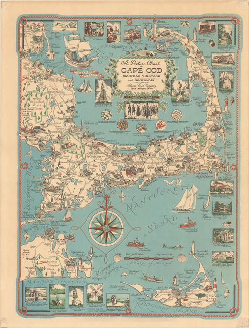
This colorful pictorial map of Cape Cod was drawn by Clara K. Chase and published by the Atlantic Card Company under the direction of William Giniewicz. The map extends to include Nantucket and part of Martha’s Vineyard and is filled with illustrations, historic sites, and copious notations. Numerous ships are drawn in the waters around the islands, including the Mayflower in Cape Cod Bay. Additional illustrations line much of the map border. Decorated by a large compass rose with an anchor (instead of a fleur-de-lis) and title cartouche surmounted by the namesake fish. Chase was the wife of popular pictorial mapmaker Ernest Dudley Chase; this is a reduced revision of his Cape Cod map, originally published in 1949. It also appeared with Clara's imprint under the title The Pilgrim Map Cape Cod Martha's Vineyard and Nantucket (1956).
References: Rumsey #7861.
Condition: A
A colorful example with a minor extraneous crease in map image. In the blank margins, there are light stains from non-archival tape on verso in the corners.