Subject: Boston, Massachusetts
Period: 1764 (published)
Publication: Le Petit Atlas Maritime
Color: Hand Color
Size:
6.1 x 8.4 inches
15.5 x 21.3 cm
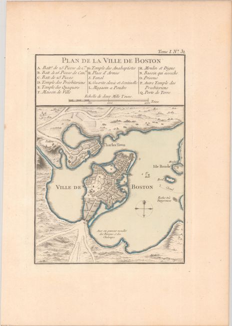
This is an attractive and early plan of colonial Boston that extends to include the harbor, Charles Town and Isle Ronde. The map portrays the area in its early evolution, detailing streets and wharves. The key reveals other important locations including gun batteries, powder magazines, prison and town hall. There is a simple compass rose in the harbor and distance scale in the key. The scale is in "Mille Toises" which is equivalent to an English fathom or a little over six feet per Toise.
References: Phillips (Atlases) #3508, v. 1 #31; Tooley (Amer), p.208, #105.
Condition: A
A crisp impression on watermarked paper with contemporary color. There is a hint of pleasant light toning.