Subject: Boston, Massachusetts
Period: 1893 (dated)
Publication: Boston Metopolitan Park Commission
Color: Printed Color
Size:
25.6 x 23.4 inches
65 x 59.4 cm
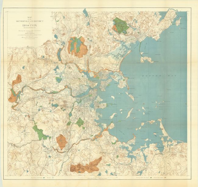
A large and very detailed map drawn on a scale of approximately one mile per inch. The map represents the beginning of the expansion of the Boston park system in 1893. It covers the region from below Dedham north to show all of Marblehead, east to include Nantasket and west beyond Riverside. Existing open spaces are shaded in green while proposed open spaces are brown. The map is accompanied by two sheets of text including "Key To Figures on the Map" (naming 106 places of interest shown on the map) and "Notes on the Map" (discussing the open spaces, both existing and as proposed by the architect). Established in 1893, the Metropolitan Park Commission worked to preserve the region's unique landscapes by acquiring and protecting park lands, river corridors and coastal areas.
References:
Condition: A
Issued folding with very faint color offsetting at bottom, a couple of spots, and a few tiny splits at the fold junctions.