Subject: New York, New England
Period: 1936-44 (circa)
Publication: Sunday News
Color: Printed Color
This lot includes six colorful newspaper maps of New York and New England by the prolific Sunday News staff artist Edwin L. Sundberg. The Sunday News was the Sunday edition of the New York Daily News, originally founded as the Illustrated Daily News in 1919. This weekly newspaper ran continuously until the latter part of the 20th century when it was absorbed by New York Daily News, which as of 2019 was the 11th largest newspaper in the United States by circulation. The maps include:
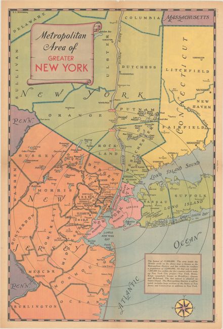
A. Metropolitan Area of Greater New York, circa 1936 (14.5 x 21.9"). This map depicts the Tri-State area, emphasizing a 50-mile radius around the city. Population is shown as 12 million. It extends as far north as the Connecticut-Massachusetts border and as far south as Burlington County, New Jersey.
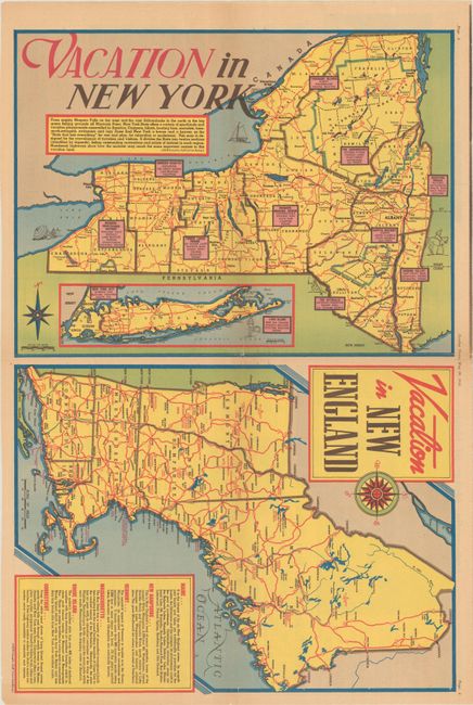
B. Vacation in New York [on sheet with] Vacation in New England, published 1940 (21.6 x 14.3"). Two maps on one sheet, highlighting tourist attractions in New York state (with an inset of New York City and Long Island) and New England. From the May 26, 1940 issue. Reference: Rumsey #12252.
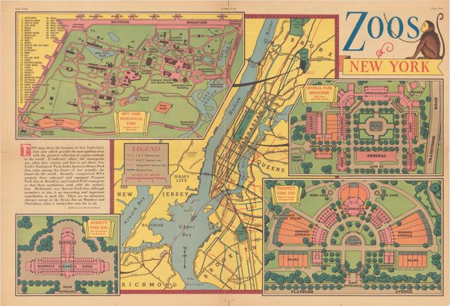
C. Zoos of New York, circa 1940 (21.9 x 14.5"). Plans of four New York zoos - New York Zoological Park, Central Park Menagerie, Barrett Park Zoo, and Prospect Park Zoo - surround a transportation map of the city. The title cartouche is accompanied by an illustration of a monkey.
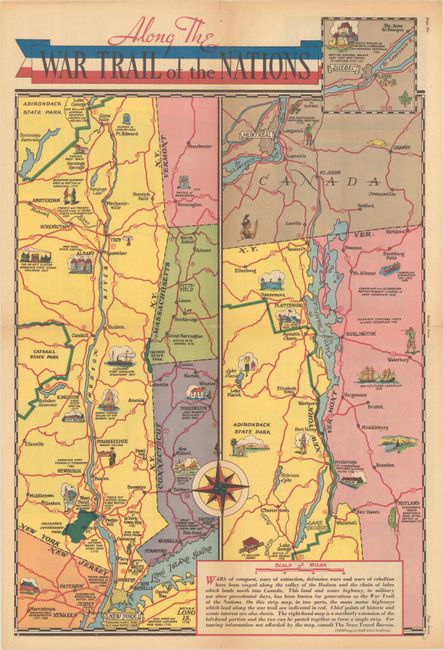
D. Along the War Trail of the Nations, circa 1936 (14.5 x 21.8"). Two maps on one sheet, with illustrations showcasing the region's history. The map at left centers on the Hudson River and shows New York's boundaries with Vermont, Massachusetts, Connecticut, and New Jersey. At right is a continuation of the map northward, showing New York and Vermont and their border with Canada. An inset shows Quebec.
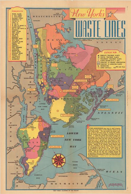
E. New York's Waste Lines, published 1939 (14.3 x 21.7"). This thematic map identifies waste treatment plants, incinerators, sewer outfalls, and ash fills in New York City. From the March 19, 1939 edition.
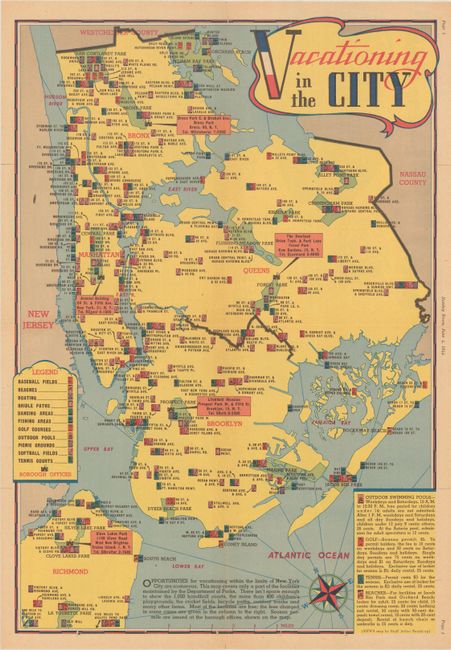
F. Vacationing in the City, published 1944 (14.1 x 20.6"). This map locates recreational sites throughout the city. From the June 4, 1944 edition.
References:
Condition: B+
Maps are all colorful examples, issued folding. The sheets are lightly toned with some small holes and a few short edge tears, a couple of which have been closed on verso with archival tape.