Subject: Long Island, New York
Period: 1857 (dated)
Publication:
Color: Black & White
Size:
35.1 x 24.6 inches
89.2 x 62.5 cm
The Office of Coast Survey is the oldest U.S. scientific organization, dating from 1807 when Congress directed that a "survey of the coast" be carried out. By 1836, it was called the U.S. Coast Survey and in 1878, the name was changed to the U.S. Coast and Geodetic Survey. Today the Office of Coast Survey is a division of the National Oceanic and Atmospheric Administration NOAA.
The survey teams, composed of civilians as well as Army and Naval officers, charted the nation's waterways and produced a wide array of reports, survey charts, hydrographic studies of tides and currents, astronomical studies and observations, and coastal pilots. These charts are an important record of the changing nature of the nation's coastlines. In additional to coastal charts, the U.S. Coast and Geodetic Survey produced land sketches, Civil War battle maps, and the early aeronautical charts.
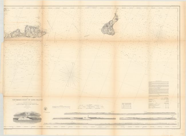
This chart covers the waters off far eastern Long Island, the eastern tip of Gardiners Island, and extending east to beyond Block Island. It is filled with excellent navigational detail including soundings, bottom types, reefs, shoals, magnetic variation, sailing directions and more. Features four coastal approach views at bottom and a lovely illustration of the Montauk Lighthouse. Published under the direction of A.D. Bache.
References:
Condition: B
Issued folding with light toning along the folds and archival repairs to several short fold separations and a 6" binding tear at left. Trimmed to just inside the left border by the binder.