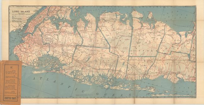
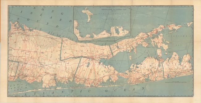
Subject: Long Island, New York
Period: 1912 (dated)
Publication:
Color: Printed Color
Size:
30.7 x 15.3 inches
78 x 38.9 cm
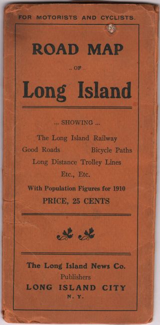
This double-sided pocket map presents the western half of Long Island on recto and the eastern half on verso. It shows the complex street-grid pattern of Manhattan, Bronx, and Brooklyn as well as the smaller grids of the towns on Long Island. A legend at left identifies good, fair and ordinary roads as well as bicycle paths, railroads and "long distance trolley roads." Text on the rear wrapper promotes the region stating that "nearly one-third of the golf courses in the state are located on Long Island" and that there are "1,000 miles of perfect macadam and shell roads for Automobiling and Driving." Folds into paper wrappers (3.4 x 7.2").
References:
Condition: B+
Issued folding with a 1.25" edge tear at left and a few short splits at the fold junctions. Paper wrappers have some wear with a small hole on the upper front wrapper.