Subject: Colonial North Carolina & South Carolina
Period: 1780 (dated)
Publication: Political Magazine
Color: Hand Color
Size:
14.9 x 10.8 inches
37.8 x 27.4 cm
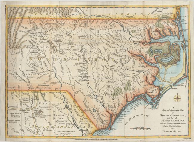
This scarce map of the Carolinas, published during the American Revolution, is apparently based on Henry Mouzon's 1778 foundation map of the region. It is filled with topographical notes and the locations of important plantations, court houses, meeting houses, swamps, and chapels. This map illustrates the region involved in the southern theater of the war. After General Clinton seized Charleston in May of 1780, the British began a campaign into the Carolinas in pursuit of the remnants of the Continental Army. The map illustrates the Battle of Camden in August, 1780, where the American General Gates was defeated by British General Cornwallis. Published by J. Bew in London.
References: Jolly #POL-16.
Condition: B+
A nice impression issued folding on a sheet that has been remargined at left and right with sections of neatline replaced in facsimile. There are a few small holes, minor soiling, and short tears and fold separations that have been backed on verso with old paper.