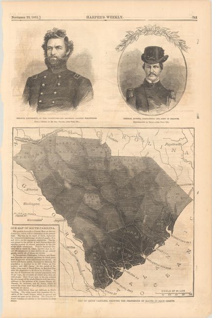
Subject: South Carolina
Period: 1861 (published)
Publication:
Color: Black & White
Size:
9.2 x 8.6 inches
23.4 x 21.8 cm
This thematic map, printed on newspaper, was issued 7 months after the Civil War began and illustrates the state's reliance on slavery. The coastal regions, shaded in dark gray, reveal the greatest slave densities while the western part of the state shows the lowest proportion of slaves to total population. Text at lower left provides additional data points including "in Lower All-Saints parish, Georgetown District, the population is reported to be 222 whites, no free negroes, and 6,468 slaves." Placed above the map are portraits of General Hunter and Colonel Dougherty, both Union officers. The verso contains 4 illustrations of Civil War sites in Virginia. Issued in the November 23, 1861 issue of Harper's Weekly.
References:
Condition: B+
Light offsetting.