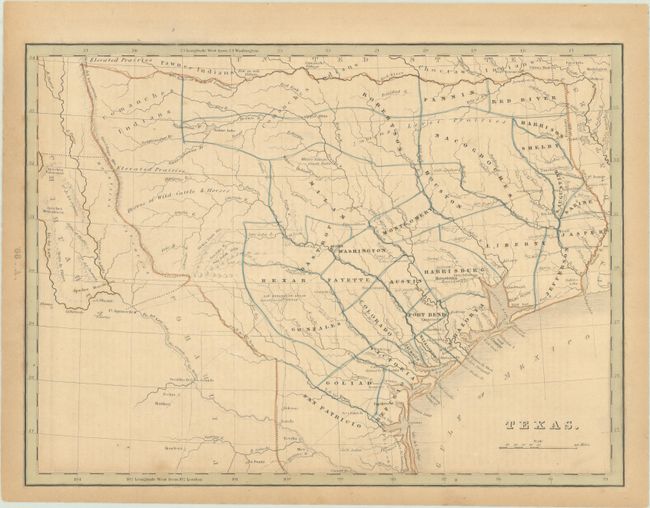
Subject: Republic of Texas
Period: 1843 (circa)
Publication: A Comprehensive Atlas Geographical, Historical & Commercial
Color: Hand Color
Size:
10.5 x 7.8 inches
26.7 x 19.8 cm
This is the uncommon later edition of Bradford's map of the Republic of Texas, which presents counties instead of land grants, Austin as the capital, and the absence of "Mustang Wild Horse Desert" in south Texas. The southwestern boundary is still delineated by the Nueces River but the map shows San Patricio County extending south from the Nueces to below the Rio Grande, thus an exertion of its claim to include lands north of the Rio Grande as its border with Mexico. Map is numbered 66.A and is accompanied by a page of descriptive text entitled "Republic of Texas."
Bradford first published the Comprehensive Atlas in 1835, and is notable for being the first American atlas to contain a separate map of Texas.
References: cf. Martin & Martin #31; cf. Taliaferro #248; cf. Phillips (A) #770.
Condition: B
Contemporary outline color with light toning and minor foxing.