Catalog Archive
Auction 198, Lot 255

"A New Map of Virginia, from the Best Authorities", Kitchin, Thomas

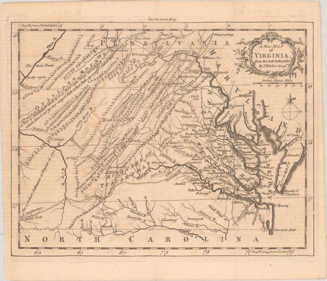
Subject: Colonial Virginia

Period: 1761 (published)

Publication: London Magazine

Color: Black & White

Size:
9.1 x 7.1 inches
23.1 x 18 cm
Download High Resolution Image
(or just click on image to launch the Zoom viewer)

This uncommon map of colonial Virginia is filled with detail of early towns, roads, rivers, waterfalls, ferry crossings, Indian boundaries and interesting notations. On the Middle Fork of the Holston River is the farm of S. Stahlmaker and at the junction of the Greenbrier and New River is the homestead of J. Keeny's. These are described as "the farthest settlements in Virginia in 1755." The title is contained in a decorative cartouche above the distance scale. Published in the November 1761 issue of London Magazine.

References: Jolly #LOND-205; Sellers & Van Ee #1436.

Condition: B+

A crisp impression with light offsetting. Issued folding.

Estimate: $275 - $350

Sold for: $150

Closed on 6/19/2024

Archived