Subject: Yorktown, Virginia
Period: 1794 (circa)
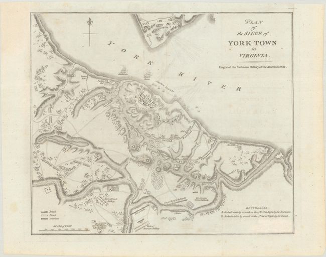
Publication: The History of the Origin, Progress, and Termination of the American War
Color: Black & White
Size:
12.8 x 10.8 inches
32.5 x 27.4 cm
This fascinating and scarce map by Charles Stedman displays the locations of American, French and British positions during the battle at Yorktown. The headquarters of General Washington and Rochambeau are noted, along with the positions of others such as Lincoln, Clinton and Siwoens. In the York River, the ships Charon and Guadeloupe, as well as many sunken vessels are noted. The Battle of Yorktown decided the course of the war and the future of the United States. This plan is based on Banastre Tarleton's plan from his important British account of the Revolution. Tarleton was in charge of Gloucester Point across the York River during the battle.
References: Nebenzahl (Amer. Rev.) #202.
Condition: B+
A crisp impression with some very light foxing and a bit of faint offsetting. Binding trim in the top left blank margin has been professionally replaced. Issued folding and now flat.