Subject: United States & Mexico
Period: 1850 (dated)
Publication: Zeitungs Atlas
Color: Hand Color
Size:
14.8 x 11.6 inches
37.6 x 29.5 cm
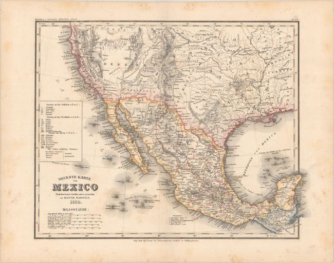
This great map of the American Southwest and Mexico shows the very rare proposed state of Deseret, which covers much of the West. The state of Deseret was proposed in 1849 by Mormon settlers in Salt Lake City, which is shown on the map as Mormonfort. In 1850, as part of the Compromise of 1850, Utah and New Mexico territories were created, encompassing the region of Deseret. It appears on only a few maps of the period, most of which are German publications. On this map, the territory boundaries are not delineated, but New Mexico is shown as a small sliver of land between Texas and Deseret. Many Indian tribes are named and located, the discoveries of Fremont are evident in the Great Basin and California, and the Gold Region is depicted in California. In Mexico, the political boundaries are delineated with a table at left showing the 21 different states. This map predates the Gadsden Purchase. Published by Joseph Meyer.
References:
Condition: B+
Contemporary color with scattered foxing that is more prominent in the blank margins.