Subject: Southern United States, Mexico & Central America
Period: 1852 (circa)
Publication:
Color: Hand Color
Size:
24.5 x 19.9 inches
62.2 x 50.5 cm
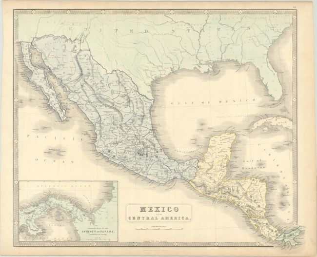
An attractive map extending from the southern United States to Panama. Mexico is delineated by state, and there are numerous place names and nice topographical detail throughout both Mexico and Central America. The border between the United States and Mexico is still on the Gila River, prior to the Gadsden Purchase (1854). In Panama, the newly created railroad linking the Atlantic and Pacific is depicted; construction on the railroad began in 1850, and it was operational in 1855. An "enlarged plan" of Panama appears in an inset at bottom left.
References:
Condition: B+
Full contemporary color and backed in linen with a vertical crease. There is light toning and soiling in the blank margins.