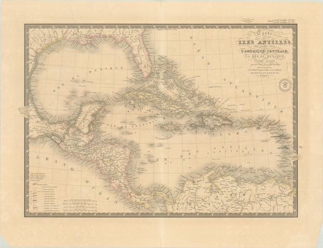
Subject: Gulf of Mexico & Caribbean
Period: 1837 (dated)
Publication:
Color: Hand Color
Size:
21.3 x 14.9 inches
54.1 x 37.8 cm
The beautifully engraved map details all of the Gulf of Mexico, the Bahamas Islands, Cuba, the Antilles and Central America. There is good detail of the cities and river systems in the southern US and Mexico. This is the second edition, dated 1837. Legend at lower left identifies via hand coloring the land areas of eleven colonial powers, including France, England, Spain, Denmark, Holland, and Sweden. Four distance scales. A very handsome map with Brue's embossed seal below the title and a decorative keyboard-style border.
References:
Condition: B+
A sharp impression with contemporary outline color on a lightly toned sheet. There is a tiny crack caused by oxidation of green pigment, minor offsetting, and some edge tears, including one entering 0.5" into map image at top left that has been closed on verso with archival materials.