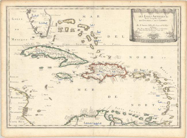
Subject: Caribbean
Period: 1656 (dated)
Publication: Cartes Generales de Toutes les Parties du Monde…
Color: Hand Color
Size:
21.8 x 15.4 inches
55.4 x 39.1 cm
This beautiful map of the Caribbean covers from the tip of Florida to the western coast of Central America and the northern coast of South America. It shows excellent detail of the Bahamas, Cuba, Jamaica, Hispaniola, Puerto Rico, and the Windward Islands. Cape Canaveral, Havana, Santiago de Cuba (S. Iago), Santiago De Los Caballeros (also S. Iago), Santo Domingo, San Juan, Cartagena, and Coro are located along with many other towns and cities. The map is decorated with a delicately engraved, drape-style cartouche. Engraved by Jean Somer.
References: Pastoureau, SANSON V [89].
Condition: B+
Contemporary outline color on a sheet with a bunch of grapes watermark. There is some minor foxing and light toning along the sheet edges. A number of place names have been underlined in blue ink.