Subject: Hispaniola
Period: 1800 (dated)
Publication: The History, Civil and Commercial, of the British Colonies in the West Indies...
Color: Hand Color
Size:
35.6 x 17.8 inches
90.4 x 45.2 cm
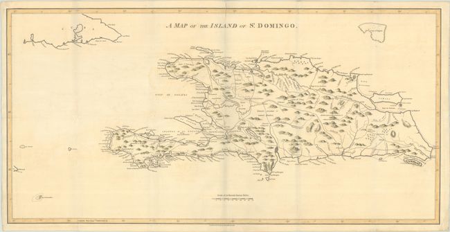
This large and interesting map of Hispaniola was made during a period of tumult as the people of the island struggled to establish independence from Spanish and French control. A dashed line indicates the "Demarcation line between the French & Spaniards as fixed in 1776." A public road system is clearly marked, and the rivers are well delineated. The illustration of topography has yet to achieve a degree of sophistication, but place name detail is good and reflects the French and Spanish influence. The distance scale uses British Statute Miles. Published by Stockdale. This is the original 1800 edition of the map, with 18 additional centimeters at left, allowing for more coverage of the Cuban coastline and a small portion of Jamaica.
References:
Condition: B+
A crisp impression with light offsetting and a 2" fold separation at top that has been repaired with archival materials on verso. Issued folding.