Subject: Haiti
Period: 1764 (circa)
Publication: Le Petit Atlas Maritime
Color: Hand Color
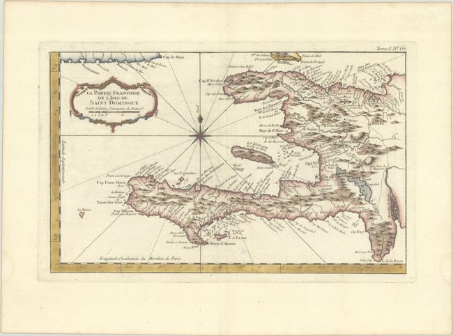
A. La Partie Francoise de l'Isle de Saint Domingue, (13.6 x 8.6"). This is a copper engraved chart detailing the western half of the island (Haiti) while it was under France's domination. Abundant place name detail is noted along the coastal region while the interior's topography and watershed are nicely developed. Rococo-style title cartouche, rhumb lines, compass rose, and fleur-de-lys decorate the chart. Condition: A nice impression with wide margins, faint offsetting, and an unobtrusive spot at bottom center.
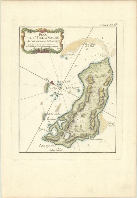
B. Plan de l'Isle a Vache a la Coste du Sud de S. Domingue, (6.5 x 8.4"). This single-page map details the island of Ile a Vache that lies off the southwest coast of Haiti. The map details the surrounding shoals, rocks, islets, and more. Condition: A nice impression on a bright sheet with minor marginal soiling.
References:
Condition: A
See description above.