Subject: Guadeloupe
Period: 1758-85 (circa)
Publication:
Color: Hand Color
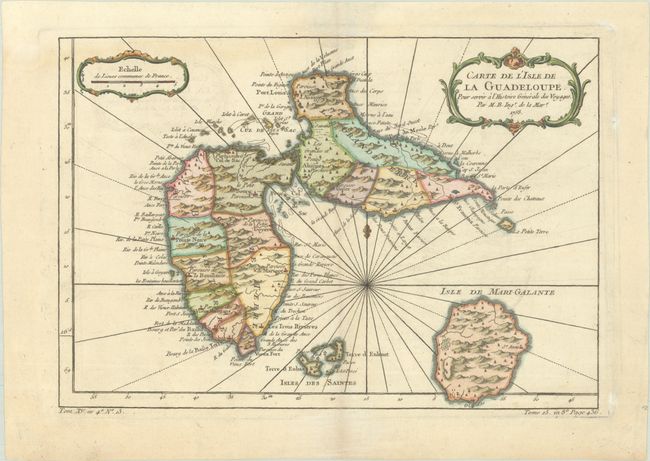
A. Carte de l'Isle de la Guadeloupe, pour Servir a l'Histoire Generale des Voyages, by Jacques Nicolas Bellin, from La Harpe's Histoire Generale des Voyages, dated 1758 (12.0 x 8.3"). A very handsome, small map adorned with rhumb lines, fleur-de-lys, and two decorative rococo-style cartouches. Filled with good detail and place names throughout. Also includes the islands of Mari-Galante, Terre d'Enhaut, and Terre d'Enbas. Reference: Sellers & Van Ee #2009. Condition: A nice impression on a sheet with a bunch of grapes watermark. There is minor offsetting and a faint dampstaining that enters the image at top left.
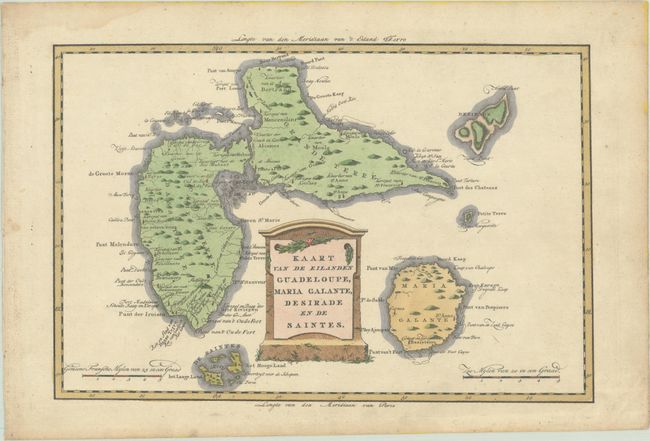
B. Kaart van de Eilanden Guadeloupe, Maria Galante, Desirade en de Saintes, by Bonne/Bachiene, from Atlas, tot Opheldering der Hedendaagsche Historie, circa 1785 (12.6 x 8.4"). This is an attractive, scarce Dutch version of Bonne's map of Guadeloupe and the nearby islands. There is good detail, mostly along the coastline with locations of rivers, anchorages, mountains, villages and towns, and churches. The decorative title cartouche forms the heart of the composition. Condition: A sharp impression with a Strasbourg lily watermark. There is a light dampstain at top left and marginal soiling.
References:
Condition: A
See description above.