Subject: South America
Period: 1795 (dated)
Publication: History of America
Color: Hand Color
Size:
12.8 x 17.8 inches
32.5 x 45.2 cm
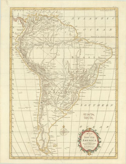
This handsome map of the continent features good detail of towns, villages, ports, and topography. Early roads are delineated stretching from Quito to La Paz and from Porco, Bolivia to Buenos Aires. Much of the central part of the continent is sparsely mapped, with river's courses shown in conjectural dotted lines. A fragment of coastline to the northeast of the Falklands represents the mythical Pepys Island, which was fabricated by William Hacke to please Samuel Pepys, the secretary of the British Admiralty. The delicately engraved title cartouche indicates Kitchin is the Hydrographer to his Majesty. Published by W. Strahan and T. Cadell.
References:
Condition: A
Issued folding, now flat, with minor extraneous creasing and faint offsetting.