Subject: South Pole
Period: 1934 (dated)
Publication:
Color: Printed Color
Size:
23 x 17.2 inches
58.4 x 43.7 cm
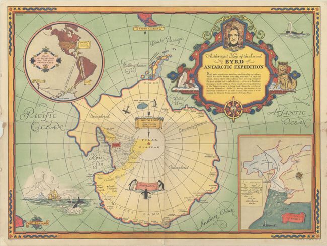
Consumers who collected enough Grape-Nuts box tops were rewarded with this terrific pictorial map of the second Byrd expedition to the Antarctic (1933-34). Designed by George Annand for General Foods, the map highlights the effort to radio broadcast the adventure, sponsored by General Foods. It depicts the Antarctic with plenty of place names along the coast. Little America is located in the Ross Ice Shelf, the "Most Inaccessible Area" is indicated by a blue circle, and large areas are labeled as "Unexplored." A sign near the South Pole commemorates Byrd's first voyage to the Antarctic as well as the expeditions of Amundsen (1911) and Scott (1912). Small portions of South America and New Zealand are shown. Whales and a sailing ship are pictured in a vignette at bottom left. The elaborate decorative title cartouche incorporates a portrait of Byrd, penguins, a dog, and compass rose. An inset at top left tracks the route of the expedition and the path of the radio broadcast. Another inset at bottom right shows the Bay of Whales, with a detail map of Little America.
Annand (1890-1980) was a commercial freelance artist. Born in Michigan, he attended art school in Detroit before moving to New York and taking classes at the Art Students League. Annand worked on a variety of projects during his career, including pictorial maps, dust jackets, illustrated books, and advertisements.
References: Hornsby (Picturing America) pp. 34-38.
Condition: B+
Issued folding with light wear and soiling along the folds, a few tiny abrasions, and a small separation at the fold intersection. There is a fold separation at bottom that has been closed with archival tape on verso, a small chip in the left blank margin, and small tack holes in the corners of the sheet.


