Subject: Argentina & Uruguay
Period: 1597 (published)
Publication: Descriptionis Ptolemaicae Augmentum
Color: Black & White
Size:
11.4 x 9.1 inches
29 x 23.1 cm
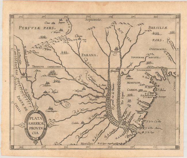
This fascinating map is from the first printed atlas relating exclusively to America. The map provides graphic details of the Rio de la Plata and its tributaries based on early Spanish explorations in search for the Silver Mountain of the White King and the lost city of Los Cesares. Sebastian Cabot's ill-fated settlement at S. Espirito is shown at the confluence of the Carcarana and Parana Rivers and Cabeza de Vaca's settlement of Assumption (Asunción) is located on the banks of the Rio Lepeti. The settlement on the R. de Buenos Arres, first established in 1536, is not noted on this map as it had been abandoned after Indian attacks in 1539 and 1541.
References: Mickwitz & Miekkavaara #307-4.
Condition: A
A dark impression on a sheet with a coat of arms watermark, a faint stain to the right of the title cartouche, and a minor dampstain in the top margin. Small remnants of hinge tape on verso.