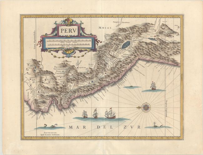
Subject: Peru
Period: 1652 (circa)
Publication: Nouvel Atlas...
Color: Hand Color
Size:
19.2 x 14.8 inches
48.8 x 37.6 cm
A large compass rose orients north to the left on this map of the Empire of Peru. It covers the Pacific coast of South America from Ecuador as far south as the Atacama Desert in the northern reaches of Chile. It includes the Potosi silver mines, Titicaca, Cusco, Quito and numerous other towns and villages. The large cartouche incorporates both the title and the distance scales and is decorated with sea shells. The sheet is further decorated with four Spanish galleons and three sea monsters. This map is one of the many similar maps that were produced by Jansson and Blaeu. French text on verso, published between 1652-58.
References: Van der Krogt (Vol. I) #9820:1.
Condition: B+
A crisp impression on a bright sheet with light extraneous creasing at bottom center, a few tiny spots of foxing, short centerfold separations at top and bottom that have been repaired with archival materials, and a printer's crease that runs parallel to centerfold.