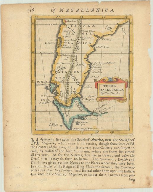
Subject: Southern South America
Period: 1680 (circa)
Publication: Geography Rectified
Color: Hand Color
Size:
4.3 x 5 inches
10.9 x 12.7 cm
This elegantly engraved small map extends from Valdivia in Terra Magellanica through Patagonum and south to Cape Horn. The map depicts the Strait of Magellan and Le Maire Strait, with a Brewers Streits in between I. Staten and a partially defined coastline to its east. The Andes Mountains prominently run down the center of the map. According to the text below the map, "As for the Natives, they live in Caves, and adore the Devil, that he may do them no harm." The map was originally issued in the first edition of Morden's uncommon miniature world atlas. On a sheet of English text measuring 6.3 x 7.9".
References: King (2nd ed.) pp.148-9; Shirley (BL Atlases) T.MORD-2a #54.
Condition: B+
A nice impression on a lightly toned sheet with a few minor spots of foxing. Remnants of paper tape on verso.


