Subject: Europe
Period: 1739 (published)
Publication: Salmon's Modern History
Color: Hand Color
Size:
10.3 x 7.8 inches
26.2 x 19.8 cm
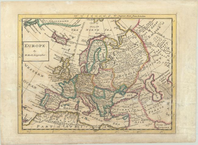
This lovely map of the continent is done in Moll's singular engraving style. The map extends to show parts of Greenland (where Hudsons hold with Hope and icy mountains are noted), northern Africa, and the Middle East, stretching far enough east to include the northern part of the Persian Gulf (here called Gulf of Bassora). It depicts some topographical detail and names several major cities. Nova Zembla appears with only one clearly defined coast.
References: McCorkle (18th C. Geography Books) #349 Vol. II [3].
Condition: B
A sharp impression with light, uneven toning and an old library blind stamp in the top right corner of the image. There is a horizontal tear across the map that has been repaired on verso with old paper.