Subject: Europe, Southwestern Germany
Period: 1745 (circa)
Publication: Mathematischer Atlas
Color: Hand Color
Size:
16.8 x 11.6 inches
42.7 x 29.5 cm
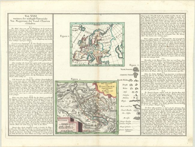
This fascinating sheet featuring two small maps was published in Mathematischer Atlas by the German astronomer Tobias Mayer. The first map, Europa (5.2 x 4.3"), is a simple outline map showing Europe as it was configured in 1744; aside from basic political divisions, only a scattering of major cities are named. The second map, Die Gegend um Esslingen Abgezeichnet von T. Majer... (6.0 x 5.1"), details the region around Esslingen in southwestern Germany, the hometown of Mayer. The sheet is intended as instruction for mapping land charts and includes as "Figura 3" a legend showing the various pictograms used to identify towns and cities, castles, rivers, topographical information, and more. In 1746, shortly after the publication of Mathematischer Atlas, Mayer began work with the Homann firm and introduced new scientific methods of mapmaking. The maps are flanked by German text at left and right.
References:
Condition: B+
A crisp impression on watermarked paper with light toning along the centerfold and a small rust spot in the text at right. Small remnants of hinge tape on verso.