Subject: Britain
Period: 1730 (circa)
Publication: Atlas Novus
Color: Hand Color
Size:
19.5 x 22.9 inches
49.5 x 58.2 cm
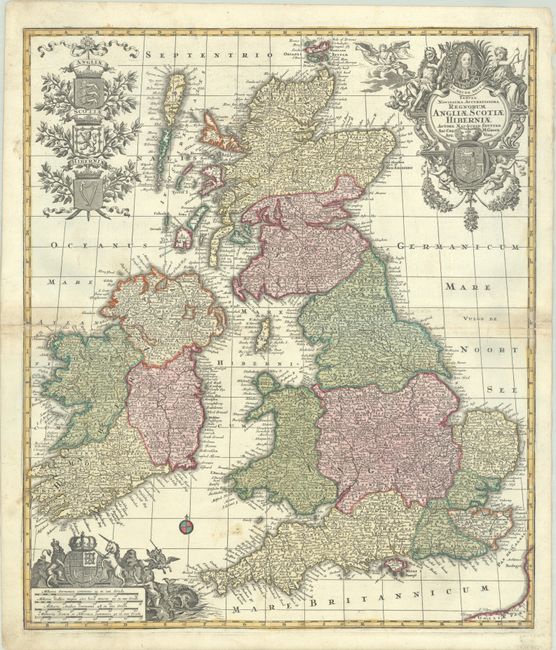
This large and decorative map of the British Isles first appeared in Seutter's Atlas Geographicus in 1720, and is here shown in the second state with "Sac. Caes. M. Geogr." added in the title cartouche. The cartouche features a portrait of George I surrounded by allegorical figures, and is balanced at top left with the shields of England, Scotland, and Ireland. An additional illustration at lower left containing four distance scales depicts the Stuart coat of arms.
References: Shirley (BI to 1750) Seutter #1.
Condition: B+
A sharp impression with full contemporary color on a bright sheet with a small coat of arms watermark. There is light soiling in the Bristol Channel, some toning along the centerfold, and centerfold separations at right and left that have been repaired on verso with old paper.